


chemin Adolf Munkel Dolomites

med88
User

Length
11.2 km

Max alt
2018 m

Uphill gradient
461 m
Km-Effort
17.3 km

Min alt
1661 m

Downhill gradient
461 m
Boucle
Yes
Creation date :
2025-06-27 07:57:29.767
Updated on :
2025-06-30 15:03:00.233
2h49
Difficulty : Medium

FREE GPS app for hiking
 SityTrail
IGN / Geographical institutes
SityTrail Plus
The world is yours!
About
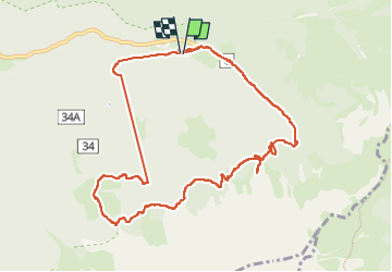
Trail Walking of 11.2 km to be discovered at Trentino-Alto Adige/Südtirol, South Tyrol, Villnöß - Funes. This trail is proposed by med88.
Positioning
Country:
Italy
Region :
Trentino-Alto Adige/Südtirol
Department/Province :
South Tyrol
Municipality :
Villnöß - Funes
Location:
Unknown
Start:(Dec)
Start:(UTM)
711483 ; 5168320 (32T) N.
Comments